India has seven major mountain ranges with peaks exceeding 1000 metres. The Himalayan mountains, which are divided into two portions – Greater Himalayas and Lower Himalayas – are the most well-known.
Table of Contents
Highest Peak in India
India’s diversified geographic topography boasts a plethora of stunning vistas, with majestic mountain ranges contributing to its splendour. Some of India’s highest peaks are found in the Great Himalayan Mountain range. It is also the source of many of India’s most powerful rivers, including the Ganges and Brahmaputra.
The Himalayan Range, Karakoram Range, Eastern Mountain Range (Purvanchal Range), Satpura and Vindhya Range, Aravalli Range, Eastern, and the Western Ghats are the most notable mountain ranges. Let’s have a look at the highest mountain peaks in India’s states. So, let’s get this party started!!!
Highest Peak in India – State Wise
The table below lists India’s mountain ranges, along with the state in which they are found and their elevation.
| Mountain Peak | Region | State | Elevation
(in meters) |
| Arma Konda | Eastern Ghats | Andhra Pradesh | 1680 m |
| Kangto | Eastern Himalaya | Arunachal Pradesh | 7090 m |
| Someshwar Fort | West Champaran District | Bihar | 880 m |
| Bailadila Range | Dantewada District | Chhattisgarh | 1276 m |
| Sosogad | Western Ghats | Goa | 1022 m |
| Girnar | Junagadh District | Gujarat | 1145 m |
| Karoh Peak | Morni Hills | Haryana | 1499 m |
| Reo Purgyil | Western Himalaya | Himachal Pradesh | 6816 m |
| K2 | Karakoram | Jammu and Kashmir | 8611 m |
| Parasnath | Parasnath Hills | Jharkhand | 1366 m |
| Mullayanagiri | Western Ghats | Karnataka | 1925 m |
| Anamudi | Western Ghats | Kerala | 2695 m |
| Dhupgarh | Satpura | Madhya Pradesh | 1350 m |
| Kalsubai | Western Ghats | Maharashtra | 1646 m |
| Mount Iso | Senapati District | Manipur | 2994 m |
| Shillong Peak | Khasi Hills | Meghalaya | 1965 m |
| Phawngpui | Saiha District | Mizoram | 2165 m |
| Mount Saramati | Naga Hills | Nagaland | 3841 m |
| Deomali | Eastern Ghats | Odisha | 1672 m |
| An unnamed point on the Naina Devi | Rupnagar District | Punjab | 1000 m |
| Guru Shikhar | Aravali | Rajasthan | 1722 m |
| Kanchenjunga | Eastern Himalaya | Sikkim | 8598 m |
| Doddabetta | Nilgiri Hills | Tamil Nadu | 2636 m |
| Laxmidevipalli | Deccan Plateau | Telangana | 670 m |
| Betalongchhip | Jampui Hills | Tripura | 1097 m |
| Amsot Peak | Shivalik Hills | Uttar Pradesh | 957 m |
| Nanda Devi | Garhwal Himalaya | Uttarakhand | 7816 m |
| Sandakphu | Eastern Himalaya | West Bengal | 3636 m |
The Top 10 Highest Peaks in India
The country’s mountains are significant for ecological, social, and economic reasons.
The Himalayas, the world’s highest mountain range with some of the world’s highest peaks, are also found in India. The tallest peaks in India, including as Kanchenjunga, Nanda Devi, and Kamet, are found in the Karakoram mountains, Garhwal Himalaya, and Kanchenjunga.
In the ranges and among the highest peaks, many wildlife sanctuaries and national parks have been established.
Anyone who has heard of India, whether a native or a foreigner, is familiar with the subcontinent’s diversity, not just culturally and linguistically, but also in terms of natural geography, which includes valleys, mountains, rivers, vegetation, and fauna.
The top 10 Highest Peaks in India are discussed here.
K2 Peak (height: 8611 m)

K2 located between Baltistan and Xinjiang is the highest peak on the Indian subcontinent.
It is Karakoram’s highest peak.
Col. T.G. Montgomerie of the Survey of India discovered the mountain in 1856, and it was given the designation K2 since it was the second-highest peak in the Karakoram Range. Mount Godwin Austen is named after Col. H.H. Godwin Austen, a 19th-century English geographer who was the peak’s first surveyor.
Mount K2, also known as Godwin-Austen, is higher than Kangchenjunga, but it is in Pakistan Occupied Kashmir (POK). K2 is the second-highest mountain on the planet.
State Location: Jammu & Kashmir
Kangchenjunga Peak (height: 8586 m)
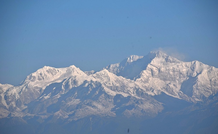
Mount Kanchenjunga is the highest peak in India and the third-highest in the world, located on the Nepal-India boundary in Sikkim’s Great Himalayas range.
Kangchenjunga or Khangchendzonga are other spellings. It is only 262 metres lower than Mount Everest, with an elevation of 8,586 metres (28,169 feet).
Kangchenjunga’s five summits, four of which are over 8,450 metres high, are referred to as “the five riches of the high snow” in Tibetan.
Buddhism has a lot of religious significance. Because the peak is considered sacred, no one has ever stood on it.
Climbers stop short of the summit to keep a promise made to the Chogyal (former rulers of Sikkim) that the mountain peak would be preserved.
Joe Brown and George Band, members of a British expedition, were the first to climb it in 1955. This location is ideal for adventurers and hikers. For trekkers, there are two options: south base camp or north base camp.
The south base camp, at 4,740 metres, is recommended since it is less difficult than the north base camp, which is at 5,140 metres. Both base camps provide spectacular views of the majestic Kanchenjunga.
State Location: Sikkim
Nanda Devi Peak (height: 7816 m)

Nanda Devi is India’s second-highest Himalayan peak. It is located in the Garhwal Himalayas region of Uttarakhand, where it claims the highest elevation in the state. Because Kanchenjunga is located on the Indian-Nepal border, Nanda Devi can be considered the highest peak on the Indian mainland as a whole.
Until western surveyors discovered Dhaulagiri in 1808, it was the world’s highest known peak. According to legend, the goddess Nanda, Shiva’s wife, resided there.
Nanda Devi National Park, one of India’s high-altitude national parks, is located near the top of Nanda Devi.
It has a tremendously diverse alpine flora and wildlife. In 1982, UNESCO designated the park as a World Heritage Site.
Snow leopards, red foxes, and Himalayan musk deer are among the park’s most elusive animals. If you want to know where you can see snow leopards in India, read this post.
The Garhwal region, located in the Himalayan foothills, is a popular trekking location and an interesting option for an adventure vacation.
State Location: Uttrakhand
Kamet Peak (height: 7756 m)
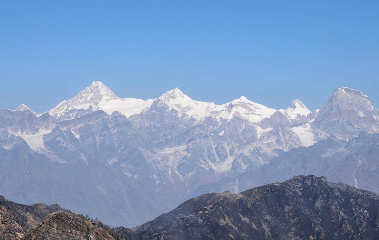
Kamet Peak is India’s third tallest peak. The Kamet is the tallest peak in Uttarakhand’s Chamoli District, located in the Zaskar mountain range of the Garhwal region. It lies near Tibet and is surrounded by three more tall peaks. Furthermore, because Kamet is located north of the main range, it is a distant and rough location for access and trekking.
It is situated near the Tibetan Plateau in the Garhwal region.
It is one of India’s top three highest peaks and is located near the Tibetan border. Because of its location on the Tibetan Plateau, the Kamet mountain is not as approachable as some other Himalayan summits.
A British expedition team achieved the first successful ascent of the summit in 1931.
State Location: Uttrakhand
Saltoro Kangri Peak (height: 7742 m)
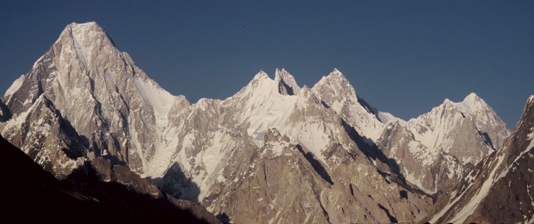
Saltoro Kangri, at a height of 7,742 metres (25,400 feet), is India’s fourth-highest peak, located deep within the Karakoram mountain range.
It’s also known as the Saltoro Mountains’ tallest mountain, which is a subrange of the Karakoram range.
The Saltoro Kangri Peak is India’s fourth-tallest peak. The Saltoro Kangri is the tallest peak in the Saltoro Mountain Range, which is a sub-range of the Karakoram Mountain Range (the biggest range of greater Himalayas mountains). The Siachen Glacier, which is located in Saltoro, is one of the world’s longest glaciers. It is the world’s 31st highest independently climbed mountain summit.
State Location: Jammu & Kashmir
Saser Kangri Peak (height: 7672 m)
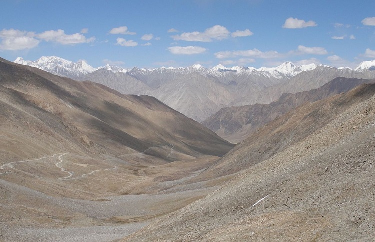
Saser Kangri is India’s fifth highest peak and the world’s 35th tallest mountain. The Sasser Kangri is a collection of five spectacular peaks in the Saser Muztagh range in the Indian states of Jammu and Kashmir. It is also one of the sub-ranges of the larger Karakoram range, and it is located to the southeast of the Karakoram range.
The Indo-Tibetan Border Police mountaineers achieved the first successful ascent of the Saser Kangri peak in 1973.
State Location: Jammu & Kashmir
Mamostong Kangri Peak (height: 7516 m)
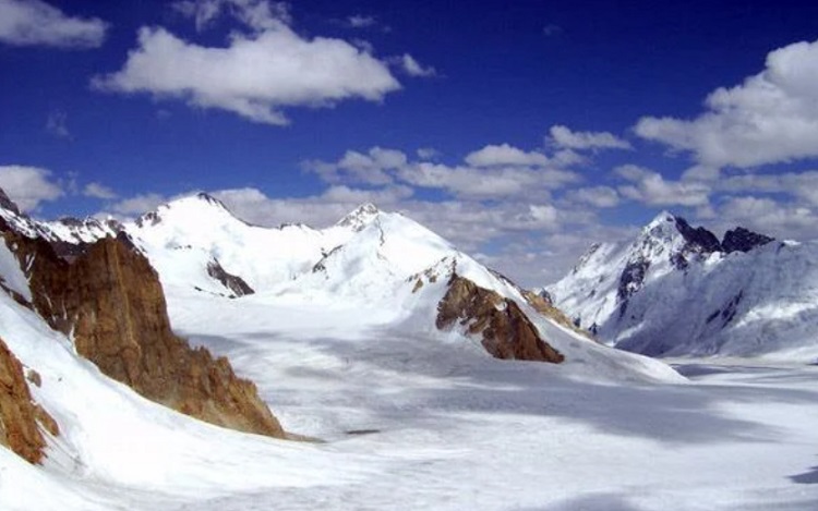
Mamostong Kangri is India’s sixth highest mountain and the world’s 48th highest summit independently. It is the tallest peak in the Rimo Mustagh sub-range of the Great Karakoram range. It is at a towering height of 7,516 metres (24,659 feet) and is close to the Siachen Glacier.
It is the highest point in the Rimo Mustagh subrange of the Karakoram range in Ladakh, near the Sino-Indian border.
Mamostong Kangri I (7,516 metres) and Mamostong Kangri II (7,025 metres), as well as a cluster of subsidiary summits, make up the Mamostong massif.
The Mamostong Kangri is one of India’s least explored Himalayan summits due to its isolated location. In 1984, an Indo-Japanese expedition was commanded by Col. B.S. Sandhu became the first to summit the mountain.
State Location: Jammu & Kashmir
Rimo Peak (height: 7385 m)
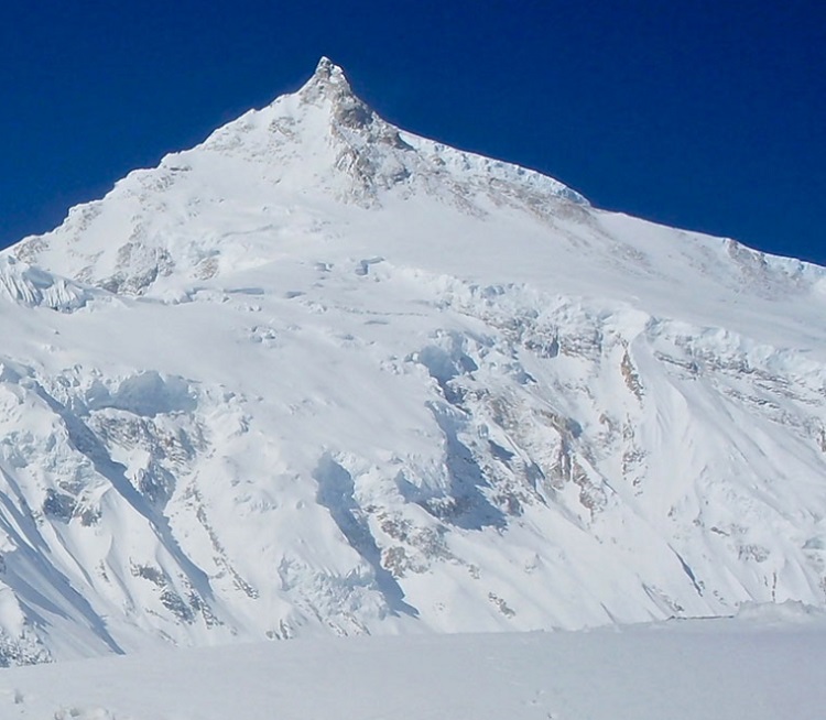
Rimo is a Japanese word that means striped mountain.’ Rimo I, with an altitude of 7,385 metres, is the major summit of the Rimo mountain range, which comprises six summits (24,229 ft).
The Rimo is located in the famed Karakoram ranges, on the northern side of Rimo Muztagh. The Rimo mountain range is made up of four peaks, the tallest of which is Rimo I. The northeast Rimo Mountains and the Karakoram Pass, one of Central Asia’s most important trade routes, are located to the northeast.
Rimo II (7,373 metres), Rimo III (7,233 metres), Rimo IV (7,169 metres), Rimo V (6,882 metres), and Rimo VI (6,882 metres) are the other peaks (6,846 meters).
Filippo De Filippi, an Italian mountaineer, led the first expedition to the summit in 1914. It was later explored by Philip Visser, a Dutch explorer and mountaineer, in 1929.
State Location: Jammu & Kashmir
Hardeol Peak (height: 7151 m)
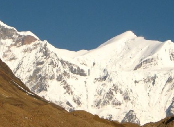
When it comes to India’s tallest peaks, Hardeol Peak is ranked eighth. One of the most well-known summits in the Kumaon Himalaya is Hardeol.
Hardeol, also known as the Temple of God, is located on the Sanctuary’s northern side, guarding Nanda Devi. It’s in Uttarakhand’s Pithoragarh district, in the Milam valley.
State Location: Uttrakhand
Chaukamba Peak (Height: 7138 m)
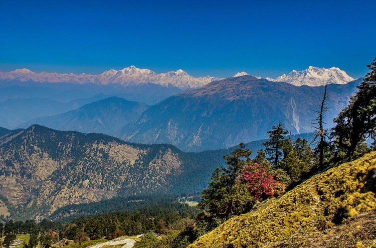
The Chaukhamba peak is the tallest mountain of the Gangotri group, which is located in Uttarakhand’s Garhwal Himalaya region. The Gangotri Group consists of four peaks, the highest of which is Chaukhamba I. The four large peaks that run parallel to each other gave Chaukhamba its name.
State Location: Uttrakhand
Trisul Peak (height: 7120 m)
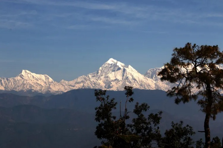
Trisul, one of the three mountain peaks that make up a specific group of summits, is ranked 10th on the list and is located in the hilly region of Kumaon in Uttarakhand. Trisul, the highest of them all, stands at 7,120 metres. The Trishul weapon of Lord Shiva inspired the name of the trio. The Nanda Devi sanctuary is near the group’s location.
State Location: Uttrakhand
Frequently asked question
Which is the highest mountain peak in India?
Kangchenjunga is India’s tallest peak. With an elevation of 8,586 metres, it is the world’s third tallest peak.
Which mountain peak is named after Lord Shiva’s weapon Trishul?
Trishul Peak (height: 7120 m)
Is k2 the highest mountain peak in India?
Mount K2, also known as Godwin-Austen, is higher than Kangchenjunga, but it is in Pakistan Occupied Kashmir (POK). K2 is the second-highest mountain on the planet.
What is the height of Kanchenjunga?
The height of Kanchenjunga is 8586 meters.
Which is the highest mountain peak in the world?
Mount Everest is the world’s highest peak. It is located at an elevation of 8,848 metres (29,029 feet) above sea level.
Which Indian peak is the 48th independent highest peak in the world?
Mamostong Kangri Peak is the 48th independent highest peak in the world.
Leave a Reply